Cozumel History Soil
Defining Cozumel’s History Through it’s Soil & Earth
Studying soil leads interesting results……
Cozumel has recently been lucky enough to be visited by a research team from the Department of Edaphology at the Institute of Geology. (or Departamento de Edafología del Instituto de Geología.) Headed up by a post-graduate coordinator, Elizabeth Solleiro Rebolledo, the team has been studying the Yucatan Peninsula and has recently incorporated Cozumel into the study. The results are not only very interesting but can also paint a very clear picture of the history of the island from it’s soil and earth.
Solleiro Rebolledo was recently interviewed by El Semanario and explained the study this way: “It’s a project that combines several things; on the one hand we are studying the rocks that make up the Yucatan Peninsula, which tell us about the geological history of the site and at the same time the soils that are developed on those rocks. So the idea is that we can have a model how the Peninsula has evolved in the last, maybe 200 thousand years”
For many years, researchers have been studying the soil of Playa del Carmen, Cancun and even Merida, Through their studies they can determine the age of specific areas of soil -, 300,000 years ago, or 200 thousand years, or 50 thousand years ago and from that extrapolate different environmental conditions, such as when the sea level was lower or higher.
This type of research is not without chances, in fact the Coordinator referred to the limestone rock that makes up both the island of Cozumel and the Yucatan Peninsula as “resembling Gruyer cheese,” due to it’s many holes. These holes allow soil to slip through, creating areas that can’t be studied since they literally have no topsoil. The team has to locate gaps where there are no holes and the soil can sometimes be as thickas 30 cm He pointed out that the limestone rock in Yucatan is formed by holes,
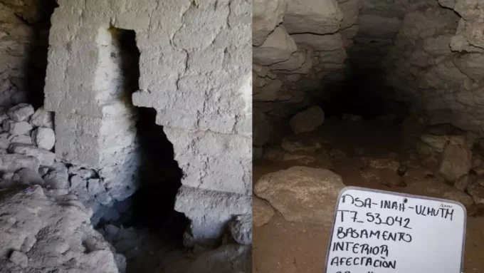
Cozumel resident, and famous speleologist Germán Yáñez has been lending his expert advice in the area of El Cedral. The first phase of the Cozumel project will be to identify areas of interest including caves, cenotes and sascaberas in order to study the changes in the soil from sea to earth.
“This will give us a geological history of the island and its origin, and will help to project models to know the soil and atmosphere that was there years ago. It will help predict climate change in the future and what will come to the island, stated Germán Yáñez.
El pasado de Cozumel definido a través de sus suelos
El estudio de suelos arroja resultados interesantes. . .
En fechas recientes Cozumel a tenido la fortuna de recibir la visita del Departamento de Edafología del Instituto de

Geología que encabeza Elizabeth Solleiro Rebolledo. El equipo ha realizado estudios de la Península de Yucatán, y hace poco integraron a Cozumel dentro del estudio. Los resultados no sólo son sumamente interesantes, sino que también describen una clara imagen del pasado de la Isla a través de sus suelos.
Solleiro Rebolledo fue entrevistada hace poco por El Semanario donde explicó el estudio de esta manera: “Es un proyecto que combina diversas cosas. Por un lado, estudiamos las rocas que conforman la Península de Yucatán; que nos hablan del pasado geológico del sitio y los suelos que se desarrollan sobre esas rocas. Por lo tanto, la idea es obtener un modelo que describa, tal vez, la evolución de la Península durante los últimos 200 mil años”.
Los investigadores han estudiado los suelos de Playa del Carmen, de Cancún e incluso de Mérida, durante muchos años. Sus estudios les permiten determinar la edad de aéreas específicas de suelos; 300,000 o 200 mil años o 50 mil años, y con base en ello pueden extrapolar distintas condiciones medioambientales como niveles del mar más elevados o más bajos.
Este tipo de investigaciones no se libran de coyunturas. De hecho, el Coordinador indicó que la roca caliza que forma la Isla de Cozumel y la Península de Yucatán hace que “semejen un queso tipo gruyere” en virtud de los múltiples hoyos. Estos hoyos permiten que el suelo se deslice dentro de ellos creando áreas que no pueden estudiarse ya que literalmente carecen de capa superior de suelo. El equipo debe ubicar espacios donde no existen huecos, y el suelo en ocasiones puede tener un grosor de hasta 30 cms. El Coordinador señaló que la piedra caliza en Yucatán está formada por hoyos.
Germán Yáñez, famoso espeleólogo que reside en la Isla, ha prestado su experta asesoría en la zona de El Cedral. La primera fase del proyecto de Cozumel consiste en identificar áreas de interés que incluye a las cuevas, cenotes y sascaberas con el objeto de estudiar los cambios en los suelos desde el mar hacia tierra.
“Esto nos presentará la historia geológica de la Isla y su origen, y ayudará a proyectar modelos para conocer los suelos y la atmósfera que existieron hace años. Ayudará a pronosticar el cambio climático en el futuro y lo que llegará a la Isla”, señaló Germán Yáñez.

______________________________
Una ex yanqui de Connecticut quien llama hogar a Cozumel desde hace más de 15 años. Laura escapó al Caribe hace años, desplazándose de una isla a otra dando clases de BUCEO. Se dedicó a perder el tiempo en Jamaica y finalmente se detuvo en Cozumel para pasar unas vacaciones de 2 semanas que aún no terminan. Convenciendo a sus padres que pagaran una elegante universidad privada, obtuvo su título en Periodismo y Laura crea semanalmente Cozumel 4You, medios sociales y artículos promocionales sobre la Isla y también es moderadora en el grupo Cozumel 4 You en Facebook que actualmente cuenta con 25,000 miembros. Fabián, s umuy tolerante marido, desde hace mucho tiempo se resignó a no tener vida privada, pues se ha visto implicado en los diversos proyectos y planes que urde Laura. Son orgullosos padres de diversos perros y gatos rescatados. Mientras contempla su paso a través de la vida en el Caribe mexicano,Laura continúa siendo la pesadilla en la existencia de su muy tradicional suegra mexicana.
- Cozumel Ironman 70.3 2026 - July 10, 2026
- Cozumel Cruise Arrivals 2026: A Projected Increase - July 10, 2026
- Cozumel 4 You NEWS - July 10, 2026


Subscribe to Our Newsletter
Bringing You the Bright Side of Cozumel Every Week


Cozumel Cruise Arrivals 2026: A Projected Increase
Cozumel Cruise Arrivals 2026: A Projected Increase Cozumel’s cruise ship arrivals are...

Cozumel Cruise Ship Arrivals
Cozumel Cruise Arrivals: A Bustling Week With 21 Arrivals in “Low Season”...
El Jefecino: New Ruins Discovered
El Jefeciño: A Monumental Maya City Emerges from the Jungle of Southern...

French Frigate Cozumel
French Frigate Calls into Cozumel for Semana Santa The sleek silhouette of...


Leave a comment